
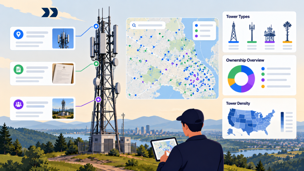
Cell tower data is information about telecommunications structures, radio installations, cellular observations, site operators, and infrastructure ownership. It is used to investigate network presence, potential colocation, competing infrastructure, and the geographic distribution of wireless assets. But a tower dataset is rarely a complete inventory of active mobile sites, and a record labeled ‘tower’ may describe something other than a distinct physical structure.
For US telecom market intelligence, the most important distinction is between an antenna structure registered with the Federal Communications Commission (FCC), a wireless license, a crowdsourced cell observation, and a commercial infrastructure asset record. They describe different entities and require different verification methods.
For the broad context, see [INTERNAL LINK -> Blog 01 | telecommunications market intelligence | suggested anchor: telecommunications market intelligence].
Key Takeaways
• A physical tower, an antenna, a sector, a radio cell, a registered structure, and a network operator are not interchangeable units.
• FCC Antenna Structure Registration (ASR) covers structures meeting registration requirements, not every rooftop antenna, pole, or small cell.
• FCC wireless licensing information can illuminate authorization and certain site records but does not provide a complete operating-site inventory.
• OpenCellID locations are estimates derived from observations; cell rows should not be counted as towers.
• Ownership, tenancy, and on-air operation may involve different companies and need separate evidence.
• Reconcile records with identifiers, attributes, geometry, and observation dates; proximity by itself is insufficient.
• Use confidence labels and field verification before treating inferred infrastructure as confirmed competitor assets.
What Counts as a Cell Tower Record?
A cell tower record can refer to a built structure, an antenna installation, an individual radio cell, or an inferred network location. The term ‘cell tower’ is routinely used as shorthand, but analysts must choose a stable entity definition before counting or mapping infrastructure.
Towers, rooftop antennas, small cells, and sectors
A ground-mounted macro tower is a physical structure that may carry equipment for multiple operators. Rooftop antenna systems and smaller pole-mounted installations may serve similar radio-network functions without resembling traditional towers. Small cells can be installed on street furniture, building façades, or other structures. A sector is a portion of radio coverage associated with antenna configuration, not necessarily an additional site.
Different sources record these assets at different levels. A structure registry may describe a support structure; a radio observation database may include several sector identifiers for the same physical site. Choose whether the analytical unit is site, structure, antenna, cell, or operator tenancy and label charts accordingly.
Why one physical site can appear as multiple records
One physical site can legitimately appear many times because it supports several radio technologies, frequency bands, operators, or sectors. A third-party database may also store duplicate observations for the same equipment under different naming or reporting conventions. Conversely, several nearby physical structures may be incorrectly merged into one estimated coordinate.
OpenCellID explicitly states that one site can support multiple cells and technologies and that its estimated positions are not surveyed tower coordinates (https://wiki.opencellid.org/docs/help/troubleshooting). A tower count built from raw cell rows will therefore overstate infrastructure and distort density comparisons. Maintain source-native records while creating a separate, confidence-scored physical-site entity.
Where Cell Tower Location Data Comes From
No single source reliably describes every active cellular site, its precise physical location, owner, and tenant operators. A practical investigation combines public filings, local evidence, crowdsourced observations, and appropriately licensed asset data.
FCC Antenna Structure Registration records
The FCC’s Antenna Structure Registration system records structures subject to Part 17 registration requirements. Useful details may include registration number, owner information, structure characteristics, and location data. These records are valuable for investigating certain macro infrastructure and validating reported structure identity, but registration is not required for every cellular installation.
The scope depends on aviation-related criteria, not whether a structure is used for mobile service. FCC guidance explains that many structures more than 200 feet above ground level, or those meeting other aviation-notification criteria, require registration (https://docs.fcc.gov/public/attachments/FCC-10-53A1_Rcd.pdf). A site absent from ASR should not automatically be classified as nonexistent.
FCC licensing and site information
The FCC Universal Licensing System (ULS) contains wireless license and application records that can identify licensees, radio services, authorized areas, and certain site-related information. License geography may be defined by a broad market area instead of one operating antenna coordinate, depending on the authorization type (https://opendata.fcc.gov/Wireless/FCC-Universal-Licensing-System-ULS-/x28i-i4z4).
A spectrum license is evidence of authorization, not proof that the holder has deployed every site within the licensed geography. Similarly, a site-associated license may not describe current commercial use, tower tenancy, or complete infrastructure ownership. Analysts should retain call signs, radio service codes, license status, source dates, and site details where available, but avoid inferring a fully constructed network from licensing alone.
OpenCellID and crowdsourced cellular observations
OpenCellID is a community-contributed dataset of cellular observations that estimates cell locations from contributed radio and device measurements. Its export schema includes radio technology, country and network codes, cell identifiers, estimated coordinates, sample counts, and timestamps (https://wiki.opencellid.org/docs/downloads/database-format).
These attributes can support exploratory mapping and identify regions for further investigation. They do not establish exact tower geography, owner, or on-air status. The ‘range’ field is an approximation associated with the estimated location and should not be interpreted as a guaranteed signal-coverage radius. Sample density also varies across places, so apparent gaps may reflect lack of observations rather than lack of service.
Local permitting records and commercial infrastructure datasets
Municipal zoning, building, utility-pole attachment, and right-of-way records may reveal proposed or existing installations omitted from national sources. The terms and detail vary substantially by jurisdiction, and a permit can describe an application, approval, modification, or completed project. Analysts must classify its status before treating it as built infrastructure.
Commercial infrastructure datasets may include surveyed sites, operator relationships, lease information, or historical updates beyond public records. Before purchasing, verify geographic coverage, what ‘site’ means, refresh procedures, source rights, and whether ownership or tenancy fields are independently confirmed. A paid dataset does not automatically eliminate missing records or attribution uncertainty.
| Source | What it can support | What it does not prove |
| FCC ASR | Registered structure locations and owner records | Complete national mobile-site inventory |
| FCC ULS | Wireless authorization, some geographic and site information | Full deployed infrastructure or tenancy |
| OpenCellID | Estimated observed cellular positions | Surveyed mast coordinates or tower count |
| Local permits | Proposed or approved works and certain installations | Confirmed completion or current service |
| Licensed asset data | Contract-dependent infrastructure attributes | Universal coverage without testing |
Why FCC Tower Records Are Not a Complete Cell-Site Inventory
FCC registration records are often mistaken for a universal tower database. That is a category error: the registry is designed for structures meeting specific registration conditions and is not intended to count every device supporting a mobile network.
Which structures require registration?
ASR obligations are tied primarily to structures that require aviation notification, such as those exceeding certain height thresholds or meeting location-specific FAA criteria. In addition, exceptions and site characteristics affect whether a particular installation must be registered. The relevant legal analysis is about the structure, not the retail carrier selling service.
A structure owner may be the registered entity, while mobile operators are tenants. An analyst should use the FCC registration record to verify the existence and characteristics of the registered structure and seek other evidence to determine radio equipment, current usage, and operator attribution. The FCC’s ASR guidance describes the registration framework (https://docs.fcc.gov/public/attachments/FCC-10-53A1_Rcd.pdf).
Why unregistered sites may still support active networks
Many operational sites are lower structures, rooftop installations, or small cells that do not trigger the same aviation-related registration requirement. Their absence from the ASR database is expected and cannot establish a coverage gap. Private indoor systems and other specialized installations further complicate efforts to infer national site density.
Treat ASR presence as positive evidence for a subset of structures, not a denominator for every antenna supporting wireless coverage. To estimate total physical sites, combine complementary records, apply explicit matching rules, and report that the resulting count remains partial unless verified against an appropriately comprehensive inventory.
How Reliable Are Crowdsourced Tower Coordinates?
Crowdsourced tower coordinates should be interpreted as estimates whose reliability depends on observation quality, distribution, and the underlying algorithm. They are often useful for exploration, but they are not substitutes for surveyed coordinates when a precise site is required.
Estimated cell positions versus surveyed tower locations
An estimated cellular coordinate can be influenced by where contributing devices traveled and the strength or distribution of observed signals. It may lie on a road or in the broader area served by a cell rather than on the antenna support itself. Surveyed structure locations have a different evidence basis and precision claim.
OpenCellID’s documentation emphasizes that its coordinates are calculated from observations and are not exact physical mast locations (https://wiki.opencellid.org/docs/help/troubleshooting). A robust system stores each source’s coordinate type and uncertainty. Where exact locations matter for field visits or colocation discussions, confirm the candidate using stronger records or direct inspection.
Coverage gaps, stale observations, and duplicate records
Crowdsourced datasets can be sparse in rural areas, less-traveled locations, private networks, and regions with few participating devices. Records can also remain after equipment is reconfigured or retired. An old timestamp does not necessarily prove a site is inactive, but it should reduce confidence that the information describes current operation.
Use observation count and last-seen date as quality indicators rather than arbitrary proof thresholds. Check identifiers across radio technologies, preserve potential duplicates until validated, and avoid converting missing measurements to a ‘no coverage’ conclusion. A comparison of two operators’ raw observed-cell counts may reflect different sampling more than different infrastructure footprints.
Matching Cell Tower Records Across Different Sources
Entity matching is essential because tower registration numbers, radio cell identifiers, company names, addresses, and GIS coordinates refer to different record systems. A reliable matching process produces candidate relationships with evidence and confidence, not invisible one-to-one merges.
Geographic proximity, site identifiers, and antenna attributes
Match exact official identifiers where available, then use geographic proximity together with structure height, address, equipment attributes, technology, and observation timing. Distance alone is risky in dense urban deployments: two physically distinct rooftop sites may be close together, while a crowdsourced cell estimate may be far from the serving antenna.
A matching pipeline should distinguish confirmed same-site, probable same-site, possible association, and unresolved candidates. Keep raw source geometry for auditing and never ‘correct’ official coordinates merely to make two databases agree. Review difficult cases through aerial imagery, permitting documents, or field evidence when commercial stakes justify the effort.
Matching network operators to physical infrastructure
Operator attribution requires evidence connecting a radio network identifier, license record, public disclosure, or lease/asset record to a physical site. MCC/MNC or similar radio identifiers can help establish network affiliation but may not identify tower owner, tenant contract, or the exact location of equipment. Infrastructure sharing and wholesale arrangements further complicate attribution.
Keep a relationship model with separate entities for physical structure, infrastructure owner, network operator, retail brand, and observation. Record the evidence source and confidence of each relationship. Do not infer tenancy simply because a cell estimate is located near a registered tower. The appropriate output may be a list of candidate structures requiring verification rather than a definitive operator map.
Determining Tower Ownership and Tenancy
Infrastructure ownership and wireless service provision are different commercial relationships. An operator may own equipment while leasing space on a structure, and the entity registered with a regulator may be the structure owner rather than every company using the site.
Tower owners, network operators, and tenants
A single site can involve a landowner, tower company, mobile network operator, subcontracted maintenance provider, and wholesale tenants. For competitive analysis, it helps to identify who controls the structure, who leases space, and who operates the transmitting equipment. These roles affect colocation options and network economics differently.
Use registries and official company disclosures for initial evidence; supplement with licensed commercial asset information when a specific tenant relationship matters. Avoid using ‘owned towers’ as shorthand for every site where a carrier operates a radio. If ownership is unconfirmed, mark it as unknown rather than assigning the best-known nearby infrastructure company.
Why public operator attribution can be incomplete
Public databases may not list every tenant or capture changes when equipment is replaced or operators consolidate. Spectrum authorization may belong to a company that is not the owner of the structure. An observed radio network may also represent roaming, sharing, or a virtual brand relationship that is not disclosed in tower-level filings.
Build a provenance register for each claimed relationship and distinguish ownership from confirmed or suspected network presence. Revisit historical site links after mergers, network swaps, and infrastructure transactions, because treating a prior filing as permanent can mislead both competitor mapping and potential partnership research.
Using Cell Tower Data for Infrastructure Intelligence
The practical value of cell tower data is to narrow uncertainty about infrastructure presence and candidate assets. It is most useful when combined with coverage, demand, permitting, and verification rather than marketed as a complete physical inventory.
Competitor site concentration
Approximate site density can help prioritize markets for further investigation, but only if the record universe is consistently defined. Compare confirmed physical sites separately from inferred cell locations and registered structures. Otherwise a region with more sectors or more crowdsourced observations may appear to have an infrastructure advantage that does not exist.
Where source coverage is uneven, publish counts by confidence tier and map geographic areas of sparse evidence. Report per-area or population-normalized site density as an investigative indicator, not direct proof of capacity or network quality. For a geographic comparison of reported service reach, see [INTERNAL LINK -> Blog 11 | telecom coverage analysis | anchor: telecom coverage analysis].
Expansion and potential colocation opportunities
An infrastructure shortlist can identify candidate sites near intended service areas, possible structure owners, permitting activity, and the proximity of existing assets. A tower or rooftop location may warrant engineering review for colocation, but available structural capacity, lease rights, power, backhaul, and RF suitability are not established by a point on a public map.
A practical workflow first ranks candidate structures by location and evidence, then routes the shortlist to engineering and commercial diligence. Data collection and normalization can support this stage, but it cannot replace consent from owners or site-level assessment. See [INTERNAL LINK -> Blog 13 | broadband expansion planning | anchor: broadband expansion planning].
Avoiding unsupported coverage conclusions
A mapped structure does not prove that service is active, that a named operator uses it, or that subscribers obtain a given speed nearby. Coverage requires radio design, spectrum, terrain, equipment, and performance evidence that may not be visible in infrastructure records.
If the business question concerns actual network reach, compare relevant FCC modeled coverage and independent measurements instead of inferring it from tower counts (https://help.bdc.fcc.gov/hc/en-us/articles/13532984820379-What-s-on-the-National-Broadband-Map). A managed collection workflow, including custom sources and periodic matching, can help maintain an auditable asset shortlist; commercial decisions should still identify which facts are confirmed, inferred, or unknown. The objective is a credible map of evidence, not a false impression of complete network visibility.