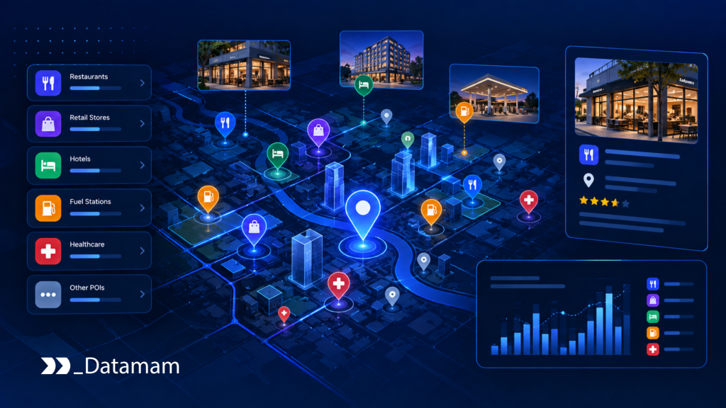
Point of Interest Data has become the location intelligence foundation behind market analysis, site planning, competitor mapping, territory design, and commercial expansion. Enterprises no longer need only addresses or map pins. They need reliable business points of interest connected to categories, coordinates, brands, locations, market context, freshness, and coverage logic. The strategic issue is not whether places can be found. It is whether place data can support accurate, governed, scalable decisions across markets, systems, and planning workflows.
Point of Interest Data as Location Intelligence Infrastructure
Point of Interest Data should be understood as infrastructure for location-based decision-making. A POI record can represent a store, restaurant, clinic, hotel, warehouse, bank branch, school, fuel station, competitor outlet, franchise unit, or commercial destination. However, a single record has limited value unless it is accurate, normalized, current, categorized, and connected to a broader market view. In enterprise use, POI data becomes valuable when it helps teams understand where businesses operate, how locations cluster, where competitors are positioned, and where market opportunities may exist.
From Business Location Records to Market Decision Systems
A business location record is not the same as a location intelligence system. A record may contain a name, address, category, and coordinates. A decision system needs more: standardized business identity, precise geospatial position, category hierarchy, brand grouping, operating status, update history, delivery format, and coverage confidence. Therefore, Point of Interest Data Services must move beyond compiling places. They must create decision-ready location data that can flow into BI tools, GIS platforms, planning systems, territory models, expansion workflows, and market analysis environments.
Why POI Data Determines Geographic Market Visibility
Geographic market visibility depends on whether the enterprise can see the commercial landscape accurately. Internal store, customer, and sales data may explain performance inside the business, but it does not reveal the full market. It does not show all competitors, adjacent demand generators, nearby services, category density, commercial clusters, or changes in local business activity. The United Nations Integrated Geospatial Information Framework frames location information as a catalyst for economic growth, opportunity, and informed decision-making when integrated with other meaningful data. For enterprises, POI data plays that same role in commercial planning.
The Enterprise Location Visibility Gap
The enterprise location visibility gap appears when organizations make geographic decisions with incomplete or inconsistent place data. A retailer may know where its stores are but not where competitors are expanding. A restaurant group may understand sales performance but not local saturation. A franchise operator may know territory boundaries but not nearby business density. A commercial real estate team may know available properties but not the surrounding business ecosystem. Without reliable POI data, geographic decisions are made with partial visibility.
Why Internal Customer and Store Data Cannot Explain the Full Market
Internal data describes what happens inside the organization. It can show store sales, customer addresses, transaction patterns, delivery zones, branch performance, lead origin, or service coverage. However, internal data cannot fully explain the market around those assets. It does not automatically reveal competitor openings, business closures, category saturation, new anchor tenants, regional brand expansion, service gaps, or changing commercial density. Point of Interest Data closes that external visibility gap by adding market structure around internal performance.
How Fragmented Place Data Distorts Market Analysis
Fragmented place data distorts market analysis because different sources represent the same real-world location differently. One source may show an old business name. Another may contain outdated coordinates. Another may classify the business under a broad category. Also, another may include duplicate entries. Another may miss the location entirely. As a result, market analysis can overcount, undercount, misclassify, or misplace commercial activity. A point of interest dataset becomes enterprise-grade only when it is normalized, validated, deduplicated, and monitored for change.
Why Point of Interest Data Has Become Infrastructure
Point of Interest Data becomes infrastructure when location-based decisions depend on recurring, governed, and scalable place intelligence. This now applies to market expansion, retail site planning, restaurant growth, logistics coverage, field sales territories, commercial real estate analysis, financial branch strategy, franchise development, healthcare access planning, competitor mapping, and AI-driven geospatial models. As more organizations use location data for strategic and operational decisions, POI quality becomes a control point.
Geospatial POI Data Across Markets, Competitors, and Trade Areas
Geospatial POI data connects business entities to physical geography. It allows teams to analyze competitor density, proximity, category concentration, underserved zones, route access, market clusters, and surrounding commercial context. However, coordinates alone are not enough. Enterprise geospatial POI data must preserve business meaning. A coffee shop, pharmacy, convenience store, hotel, urgent care clinic, bank branch, or warehouse may each require different categorization, coverage, and freshness standards. The goal is not only map visibility. It is decision-ready market visibility.
Commercial Location Data for Expansion, Planning, and Market Monitoring
Commercial location data supports expansion planning by showing where businesses, services, competitors, and demand generators exist. It can help teams assess whether a market is saturated, underdeveloped, strategically attractive, or shifting. However, commercial location data must be current enough to reflect real-world change. Business openings, closures, relocations, rebrands, category changes, and branch consolidations can alter market assumptions. A static places dataset may support one-time research. Managed POI infrastructure supports ongoing planning and monitoring.
Governance Requirements for Enterprise Places Datasets
Enterprise places datasets require governance because location data affects investment decisions, territory assignments, market forecasts, site planning, and operational analysis. Teams must understand where records came from, when they were updated, how categories were assigned, how duplicates were resolved, and how coordinates were validated. Overture Maps Foundation’s Global Entity Reference System shows the importance of interoperable geospatial identifiers for linking data across systems. For enterprise buyers, that reinforces a broader point: POI data needs stable identity, traceability, and interoperability.
| Enterprise Driver | What Changed | Why POI Data Infrastructure Is Required |
| Location-based strategy | Expansion, site selection, territory planning, and competitor mapping depend on external location data | Teams need accurate business points of interest connected to market context |
| Geospatial analytics adoption | BI, GIS, AI, and planning teams increasingly combine business data with location data | POI records must be normalized, geocoded, categorized, and delivered into analytical systems |
| Market complexity | Businesses open, close, relocate, rebrand, and change categories continuously | POI datasets require monitoring, freshness controls, and update processes |
| Competitive mapping | Teams need visibility into competitors, substitutes, anchors, and commercial clusters | Coverage quality determines whether market analysis is complete |
| Governance expectations | Enterprise teams need traceable, explainable, and auditable datasets | Source lineage, category logic, coordinate quality, and update history must be documented |
The Operating Model Behind Point of Interest Data Services
Point of Interest Data Services are not defined by a simple list of locations. They require an operating model for source coverage, entity normalization, geospatial enrichment, validation, delivery, monitoring, and governance. Each layer turns raw place records into usable intelligence. Without that model, POI data may look structured while still creating unreliable analysis. A places dataset becomes valuable when it can support repeated business decisions across regions, categories, teams, and systems.
| Operating Layer | Core Responsibility | Enterprise Output |
| Source Coverage Layer | Identify and collect location records from relevant public, commercial, and digital sources | Broad view of businesses, places, and commercial entities |
| Entity Normalization Layer | Deduplicate, standardize, classify, and group business points of interest | Consistent POI identity across datasets and systems |
| Geospatial Enrichment Layer | Add coordinates, categories, brands, address structure, market context, and spatial attributes | Location-ready data for GIS, BI, and analytics workflows |
| Validation Layer | Check accuracy, completeness, freshness, coordinate precision, and category reliability | Trusted point of interest dataset |
| Delivery Layer | Provide POI data through files, APIs, warehouses, GIS tools, or planning systems | Usable location intelligence outputs |
| Monitoring and Governance Layer | Track updates, source changes, lineage, ownership, exceptions, and quality performance | Sustainable POI infrastructure with decision confidence |
Source Coverage Layer for Places, Businesses, and Location Records
The source coverage layer determines which places can be seen. Sources may include public business registries, government datasets, mapping datasets, retailer locators, franchise directories, real estate listings, marketplace pages, travel platforms, local directories, review sites, licensing records, and commercial data feeds. Coverage should be aligned with the business question. A retailer planning expansion may need competitors and adjacent demand generators. A logistics team may need warehouses, service points, and delivery anchors. A bank may need branch, ATM, competitor, and demographic context.
Entity Normalization Layer for Business Points of Interest
The entity normalization layer turns fragmented location records into consistent business points of interest. It standardizes names, categories, addresses, brand relationships, location status, and identifiers. It also resolves duplicates and distinguishes separate locations from repeated records. This layer is essential because the same business may appear under multiple names, abbreviations, address formats, or category labels. Without entity normalization, market analysis can count the same location twice or miss important competitive density.
Geospatial Enrichment Layer for Coordinates, Categories, and Market Context
The geospatial enrichment layer adds the spatial and commercial context that makes POI data useful. This may include latitude and longitude, administrative boundaries, postal codes, neighborhoods, trade areas, drive-time zones, category hierarchy, brand grouping, opening status, building context, and nearby business clusters. Overture Maps documentation shows how modern place data can include structured categories, source information, update times, and identifiers. Enterprise POI workflows need similar discipline when building commercial location data for analysis.
Validation Layer for Accuracy, Freshness, and Completeness
The validation layer checks whether the point of interest dataset is accurate enough for decision use. Validation may include coordinate checks, duplicate detection, address verification, category review, source comparison, completeness scoring, freshness checks, and anomaly detection. A POI record with an imprecise coordinate may distort proximity analysis. A closed business that remains active in the dataset may distort market density. A missing competitor location may distort expansion planning. Validation protects analysis from location data defects.
Delivery Layer for BI, GIS, Analytics, and Planning Systems
The delivery layer makes POI data usable by business teams. Some teams need CSV or Parquet files. Others need APIs, database tables, geospatial layers, dashboards, warehouse delivery, or GIS-ready formats. Planning teams may need territory files. Analytics teams may need structured tables. GIS teams may need geometry and coordinate precision. AI teams may need feature-ready datasets. Delivery quality determines whether POI data becomes part of actual decision workflows or remains a static reference file.
Monitoring and Governance Layer for POI Reliability and Traceability
The monitoring and governance layer ensures that POI data remains reliable over time. It tracks source changes, location updates, business closures, category drift, duplicate recurrence, coordinate issues, delivery failures, and source lineage. OECD’s 2025 policy brief on data access and sharing in the age of AI emphasizes the need to balance data access and sharing with legal, technical, and organizational safeguards. POI governance applies that principle to location intelligence by making records explainable, traceable, and controlled.
Enterprise Risks Created by Weak Point of Interest Data
Weak Point of Interest Data creates risk because geographic decisions depend on accurate place visibility. If location records are incomplete, outdated, misclassified, duplicated, or poorly geocoded, downstream analysis becomes unreliable. A market may appear underserved when competitors are missing. A trade area may appear attractive because closed businesses remain in the dataset. A territory may be misbalanced because locations are misclassified. The business risk is not abstract. It appears in expansion plans, sales coverage, competitor analysis, and capital allocation.
Market Blind Spots From Incomplete POI Coverage
Market blind spots occur when the dataset does not include enough relevant businesses or locations. A restaurant expansion team may miss regional competitors. A retailer may underestimate specialty stores. A healthcare network may overlook urgent care clinics or pharmacies. A franchise brand may misread white-space opportunity. Incomplete coverage can make a market look more attractive or less competitive than it really is. Strong POI infrastructure reduces this risk by defining coverage requirements by use case, category, geography, and decision importance.
Site Selection Errors From Inaccurate Business Locations
Site selection errors can occur when business locations are wrong, outdated, or imprecisely geocoded. A coordinate placed at a postal centroid instead of a storefront can distort distance calculations. An outdated business record can misrepresent local competition. A duplicate record can exaggerate market density. The World Bank’s 2025 announcement on improving geospatial data availability in Uzbekistan notes that gaps in detailed geospatial data can limit effective territorial planning and restrict opportunities for residents and businesses. The same logic applies to enterprise location planning: weak geospatial data weakens planning quality.
Competitive Misreads From Poor Category and Brand Normalization
Competitive misreads happen when categories and brands are not normalized consistently. A fast-casual restaurant, coffee shop, bakery cafe, and convenience food retailer may compete differently depending on the use case. A bank branch and ATM may need separate treatment. A pharmacy inside a grocery store may need different logic from a standalone pharmacy. A national brand may operate through franchisees under local naming variations. Category and brand normalization ensure that competitive maps reflect real commercial relationships rather than inconsistent labels.
Planning Delays From Unreliable Commercial Location Data
Planning delays occur when teams spend time validating data manually before they can use it. Analysts may verify addresses, remove duplicates, correct categories, reconcile coordinates, and compare sources before running analysis. Expansion teams may pause decisions because market maps do not look credible. GIS teams may need to repair datasets before modeling trade areas. Reliable commercial location data reduces these delays by providing validated, structured, and documented POI records that planning teams can use with confidence.
AI and Analytics Degradation From Weak Geospatial Inputs
AI and analytics degrade when location inputs are weak. A model may predict market opportunity inaccurately if competitor density is incomplete. A territory model may underperform if business points are duplicated or outdated. A demand model may misread proximity if coordinates are imprecise. NIST’s AI Risk Management Framework is designed to help organizations incorporate trustworthiness considerations into AI systems. For location-based AI and analytics, trustworthy geospatial inputs are part of that foundation.
Build vs Buy Decisions for Point of Interest Data Services
The build versus buy decision for Point of Interest Data Services should be evaluated as an infrastructure and risk allocation question. Internal teams may manage POI data when the scope is narrow, geography is limited, and categories are stable. However, enterprise-scale POI infrastructure requires source coverage, entity normalization, geocoding, validation, enrichment, monitoring, governance, and delivery. The decision is not only whether a team can compile place records. It is whether the organization can maintain reliable location intelligence over time.
| Evaluation Area | Internal POI Data Model | Managed POI Data Capability |
| Best Fit | Narrow geographies, limited categories, low refresh frequency, strong internal GIS capacity | Multi-region, multi-category, commercial, AI-ready, or recurring location intelligence needs |
| Cost Profile | Lower visible start cost, higher hidden validation and maintenance burden | Structured cost with coverage, normalization, delivery, and monitoring accountability |
| Coverage | Depends on internal source knowledge and update capacity | Designed for systematic coverage across sources, brands, categories, and regions |
| Data Quality | Often depends on manual checks and local standards | Uses repeatable validation, deduplication, geospatial enrichment, and freshness monitoring |
| Scalability | Limited by internal team capacity and source complexity | Built to scale across geographies, categories, systems, and analytical use cases |
When Internal POI Data Operations Are Rational
Internal POI data operations are rational when the organization has limited geography, stable location categories, strong GIS expertise, and clear business ownership. A local market study, a one-time competitor map, or a narrow territory planning exercise may be manageable internally. Internal control may also make sense when proprietary location knowledge or sensitive business planning is involved. However, internal management still requires standards for source selection, deduplication, category logic, coordinate quality, and refresh.
Where Internal Places Dataset Management Breaks at Scale
Internal places dataset management breaks when scope expands across countries, brands, categories, languages, address systems, source types, and use cases. Teams must monitor business openings, closures, relocations, rebrands, duplicate records, category drift, and coordinate changes. Analysts spend time cleaning data instead of interpreting markets. GIS teams become responsible for data repair. Planning teams lose confidence in coverage. A managed point of interest dataset can reduce this burden by operationalizing source coverage, normalization, validation, and updates.
Total Cost Beyond Data Collection, Licensing, and Geocoding
The total cost of POI infrastructure extends beyond data collection, licensing, and geocoding. It includes source evaluation, category design, identity matching, duplicate resolution, coordinate validation, freshness monitoring, enrichment, documentation, delivery, stakeholder support, and exception handling. A low-cost places dataset may become expensive if internal teams must correct it before every analysis. A commercial location data program should therefore be evaluated by lifecycle cost and decision reliability, not only by record count or price per location.
Risk Allocation Across Coverage, Quality, and Operational Continuity
Risk allocation determines who is responsible when location data is wrong, stale, incomplete, duplicated, or difficult to use. Internal teams own the risk when they compile and maintain datasets themselves. Managed POI models distribute risk through source monitoring, quality controls, documentation, delivery expectations, and operational support. The right model depends on business criticality, internal capacity, refresh frequency, data sensitivity, geographic scope, and downstream dependency. A POI data partner becomes valuable when it reduces uncertainty across coverage, quality, and continuity.
POI Data Platforms vs Managed Point of Interest Data Infrastructure
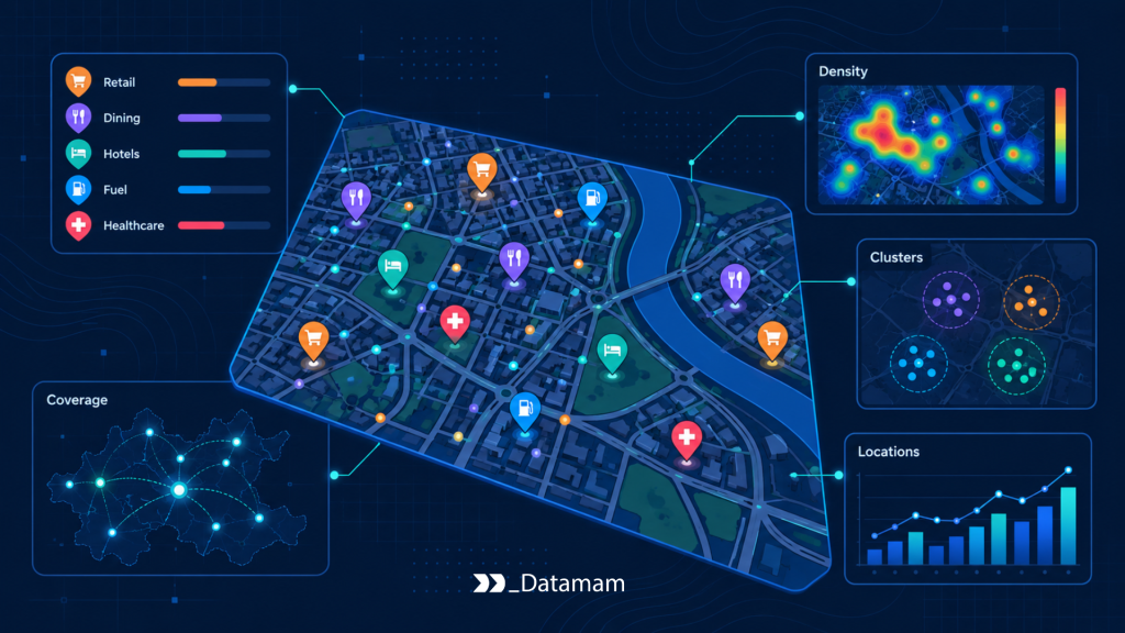
A POI data platform can provide access to place datasets, APIs, maps, search tools, dashboards, or downloadable files. However, platform access is not the same as decision-ready location intelligence. The most important work often happens below the interface: source coverage, entity normalization, category logic, coordinate precision, validation, freshness control, and delivery into business systems. Managed Point of Interest Data infrastructure combines dataset access with operational accountability.
Why Dataset Access Is Not the Same as Decision-Ready Location Intelligence
Dataset access means a team can obtain records. Decision-ready location intelligence means those records are reliable, current, normalized, relevant, and aligned with the business question. A POI dataset may contain millions of records and still fail a specific market analysis if categories are too broad, duplicates are unresolved, coordinates are imprecise, or key competitor locations are missing. A large places dataset is not automatically a useful places dataset. Usefulness depends on fit, quality, and governance.
The Ownership Gap Between Places Data Tools and Market Decisions
The ownership gap appears when data tools provide POI records but business teams remain responsible for correcting and interpreting them. Data teams may own acquisition. GIS teams may own maps. Strategy teams may own market decisions. Real estate teams may own site planning. Sales teams may own territories. If no operating model connects the dataset to outcomes, location intelligence becomes fragmented. Managed POI infrastructure reduces this gap by defining ownership across coverage, normalization, quality, delivery, and issue resolution.
Industry Applications of Point of Interest Data
Point of Interest Data applies across industries, but each use case has different quality, coverage, and refresh requirements. Retail teams use POI data to understand store networks and competitors. Restaurant groups use it to evaluate local market density. Commercial real estate teams use it to understand tenant, anchor, and surrounding business context. Franchise, field sales, and territory teams use it to allocate coverage and identify white space. The underlying POI architecture remains consistent, but the business interpretation changes.
Retail Market Planning and Competitive Store Mapping
Retail market planning uses POI data to map competitor stores, category density, anchor tenants, nearby services, and commercial clusters. A retailer can evaluate whether a potential market is underserved, oversaturated, or changing. However, retail analysis requires category-aware location data. A grocery store, discount retailer, pharmacy, specialty retailer, and shopping center anchor may influence market opportunity differently. Strong POI infrastructure helps retail teams compare markets consistently while preserving local commercial context.
Restaurant Expansion and Local Market Visibility
Restaurant expansion depends on visibility into competitors, nearby amenities, traffic generators, complementary businesses, and category saturation. A quick-service restaurant, coffee chain, casual dining concept, delivery-only kitchen, and specialty food retailer may each require different POI logic. Local market visibility also depends on freshness because restaurants open, close, rebrand, and relocate frequently. A current POI dataset helps expansion teams evaluate market opportunity with fewer manual checks and stronger competitive awareness.
Commercial Real Estate and Site Evaluation Workflows
Commercial real estate teams use POI data to understand surrounding business ecosystems, nearby anchors, tenant mix, service availability, competitive locations, and market character. A property’s value can depend on what surrounds it. Nearby grocery stores, gyms, schools, healthcare services, transit nodes, restaurants, offices, hotels, and retail clusters may all affect site evaluation. POI data strengthens site analysis by making commercial context visible and comparable across locations.
Franchise, Field Sales, and Territory Planning
Franchise, field sales, and territory planning use POI data to define market coverage, identify white space, balance territories, and prioritize outreach. Also, franchise teams may evaluate where brand presence is weak relative to demand generators or competitor concentration. Field sales teams may use business points of interest to identify prospects or service areas. Territory teams may balance workloads based on location density and commercial opportunity. Reliable POI coverage reduces planning bias and improves allocation decisions.
Business Outcomes From POI Data Infrastructure
The value of POI data infrastructure should be measured by better market visibility, faster location analysis, stronger site and territory decisions, lower analyst burden, and more reliable scaling across regions and use cases. These outcomes depend on coverage, freshness, entity quality, coordinate precision, and integration into workflows. When Point of Interest Data is designed as infrastructure, location intelligence becomes repeatable rather than manual.
Better Market Visibility Across Business Locations and Competitors
Market visibility improves when enterprises can see relevant businesses, competitors, adjacent categories, service clusters, and commercial density across geographies. This helps teams compare markets, identify gaps, evaluate competitive intensity, and interpret local context. Better visibility does not mean collecting every possible place record. It means collecting, structuring, and maintaining the place records that matter to the business decision. This distinction is critical for building usable POI infrastructure.
Faster Location Analysis for Expansion and Planning Teams
Location analysis becomes faster when POI data is already validated, categorized, enriched, and ready for use. Analysts no longer need to spend excessive time cleaning addresses, removing duplicates, verifying coordinates, or manually classifying businesses before analysis begins. Planning teams can move faster from question to interpretation. In practical enterprise workflows, structured POI infrastructure can reduce manual preparation effort by 30-60% when teams previously relied on fragmented sources and spreadsheet-based location research.
Stronger Site and Territory Decisions Through Reliable POI Coverage
Site and territory decisions improve when teams have reliable coverage of businesses, competitors, and commercial surroundings. A site can be evaluated against nearby anchors, competitor density, category mix, and access context. A territory can be balanced using business density and coverage needs. A market expansion plan can compare multiple regions with consistent data. Reliable POI coverage reduces the risk of decisions based on incomplete or outdated market views.
Lower Analyst Burden Across Geospatial Market Analysis
Analyst burden declines when POI workflows automate source coverage, normalization, validation, enrichment, and delivery. Analysts should not spend most of their time repairing location datasets. They should interpret patterns, compare markets, and support decisions. A governed POI dataset reduces recurring cleanup and creates repeatable inputs for GIS, BI, and AI workflows. The result is not only time savings. It is better analytical consistency across teams.
More Reliable Scaling Across Regions, Categories, and Use Cases
Scaling becomes more reliable when POI patterns are reusable. A mature model can expand across new regions, categories, countries, languages, address structures, and business questions without rebuilding the dataset logic from scratch. Without reusable infrastructure, every new market requires custom research. With disciplined POI operations, teams can extend coverage, validation rules, category logic, and delivery models more efficiently. This creates leverage across location intelligence programs.
Point of Interest Data as an Operational Control Point
Point of Interest Data is an operational control point because it determines how accurately an enterprise understands physical market structure. Expansion plans, territory models, competitor maps, site evaluations, field sales strategies, and geospatial AI models depend on place data quality. If location data is stale, incomplete, or misclassified, the analysis may look precise while producing flawed decisions. POI infrastructure helps control that risk by making place data measurable and governable.
Why Location Freshness Shapes Market Responsiveness
Location freshness shapes market responsiveness because commercial geography changes continuously. Businesses open, close, relocate, merge, rebrand, change operating status, or shift categories. A places dataset that was accurate six months ago may already be misleading in fast-changing categories. Freshness requirements should match the business use case. A quarterly strategic map may tolerate slower updates. A competitive monitoring workflow may require more frequent refreshes. POI data programs should define freshness by decision impact, not by generic update schedules.
How POI Data Supports BI, GIS, AI, and Planning Workflows
POI data supports BI, GIS, AI, and planning workflows by adding location context to enterprise analysis. BI teams can compare market coverage. GIS teams can model proximity and density. AI teams can use location features for prediction and classification. Planning teams can evaluate expansion and territory options. Gartner’s 2025 data and analytics predictions state that AI agents are expected to augment or automate 50% of business decisions by 2027. As decision systems become more automated, location data inputs need stronger quality and governance.
Commercial Evaluation Criteria for a POI Data Partner
Enterprise buyers should evaluate a POI data partner by coverage, reliability, normalization, delivery, governance, and operational accountability. The partner should explain how it sources records, verifies locations, normalizes categories, resolves duplicates, enriches data, monitors changes, and delivers outputs into business systems. A strong partner does not only provide a places dataset. It provides a location intelligence foundation that can support decisions across teams and workflows.
Evidence of Source Coverage and Location Data Reliability
A serious POI data capability should show evidence of source coverage discipline. Buyers should understand which sources are used, how often records are updated, how coverage is measured, how gaps are identified, and how location reliability is tested. Coverage should be assessed by category, geography, brand, business type, and decision relevance. High record count alone is not sufficient. The dataset must cover the places that matter for the enterprise’s market analysis.
Category, Brand, Address, and Coordinate Normalization Standards
Normalization standards should cover business names, brands, categories, addresses, coordinates, operating status, duplicates, and source conflicts. Buyers should ask how similar categories are distinguished, how multi-location brands are grouped, how duplicate records are handled, how coordinate precision is assessed, and how address conflicts are resolved. Weak normalization creates false precision. The dataset may appear structured while market analysis remains unreliable.
Delivery, Governance, and Operational Handoff Quality
Delivery and governance determine whether POI data becomes operationally useful. Buyers should expect documentation, data dictionaries, delivery schedules, schema definitions, lineage notes, quality indicators, refresh logic, and issue escalation. Delivery should support the systems that teams actually use, including BI tools, GIS environments, cloud warehouses, APIs, planning systems, or analytical models. Operational handoff should explain how the dataset is maintained and how changes are managed.
Conclusion: Point of Interest Data as Location Intelligence Infrastructure
Point of Interest Data has become location intelligence infrastructure because market, expansion, territory, and planning decisions depend on accurate visibility into business locations and commercial geography. A POI dataset is not only a list of places. It is a structured view of the market, built from business identities, categories, addresses, coordinates, sources, freshness, and governance.
The enterprise advantage is not access to the largest possible places dataset. It is access to reliable, normalized, traceable, and decision-ready POI data that supports market analysis, site planning, competitive mapping, territory design, AI workflows, and commercial strategy. Strong POI infrastructure reduces blind spots, improves planning speed, lowers analyst burden, and creates more consistent location intelligence across teams.
Ultimately, location-based decisions depend on the quality of location data. Organizations that treat Point of Interest Data as infrastructure build stronger foundations for geographic market visibility, commercial planning, expansion strategy, and long-term analytical scalability.
Strategic Consultation for POI Data Readiness
A strategic consultation should clarify whether the organization’s current POI data model can support its location intelligence requirements. Many enterprises already have maps, dashboards, GIS tools, internal store data, and external datasets, but still lack reliable source coverage, entity normalization, coordinate validation, category governance, and delivery into planning workflows. The assessment should identify where POI gaps, duplicates, freshness issues, category inconsistencies, or delivery limitations weaken market analysis.
Assessing Location Coverage, Quality, and Market Analysis Gaps
A POI readiness assessment should begin by mapping the business decisions that depend on place data. This includes market expansion, site evaluation, competitor mapping, territory planning, field sales coverage, franchise development, and commercial real estate analysis. The assessment should then review source coverage, record completeness, coordinate precision, category consistency, freshness, duplicate rates, and delivery requirements. From there, leadership can distinguish a GIS tool issue from a POI data infrastructure issue.
Evaluating Internal, Dataset-Based, and Managed POI Data Models
The final step is evaluating whether POI data management should remain internal, rely on a purchased places dataset, or operate through a managed POI data model. The decision should consider geography, category complexity, refresh requirements, internal GIS capacity, downstream systems, and total cost of ownership. Submit an inquiry when the objective is to clarify the right POI data operating model before expanding location intelligence, market analysis, site selection, or territory planning workflows.